Navigation
Rubber Scuba Hoses
The standard rubber scuba diving hose is what you would expect and has been around since the beginning of modern scuba, pretty much unchanged other than improvements in quality. We carry highest quality CE EN250 approved rubber hoses made specifically for scuba diving with chromed brass fittings. We offer rubber hoses for all three different types of applications used in scuba: High Pressure (HP) SPG, Low Pressure (LP) BCD/Jacket/Inflator, and Low Pressure (LP) Regulator. Our standard rubber hoses are Nitrox Ready up to 40% oxygen.
UPGRADE to Miflex Hoses for better performance than these rubber hoses!
Recommendation: In our experience Miflex double-braided polyester hoses are more reliable than rubber hoses. But keep in mind that all SCUBA hoses, both rubber or polyester, will fail sooner or later either due to age, storage conditions or handling. Prior to every dive trip you should always pressurise and inspect your hoses for mechanical damage, corroded fittings, bulges and leaks. We suggest replacing all SCUBA hoses every five years or 500 dives, whichever comes first.
Eagle Rock, Aireys Inlet
![]() Shore Dive |
Shore Dive | ![]() Shore access
Shore access
![]()
![]()
![]()
![]()
Depth: 1 m (3.28 ft) to 10 m (33 ft)
Level: Open Water and beyond.
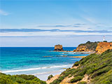
Eagle Rock is the higher of two prominent rock formations that rise up out of the ocean at Aireys Inlet, and is visible from the Great Ocean Road. It's lies within the Eagle Rock Marine Sanctuary and is a spectacular 20 metre high sea stack backed by rocks, reefs and a narrow strip of sand at the base of the backing bluff. The swirling waters around these rocks are home to marine creatures large and small.
Between Eagle Rock and Table Rock at the mouth of Aireys Inlet, the coast is composed of 20 to 30 metre high bluffs, fronted by rock platforms, reefs and sea stacks. Standing at 20 metres above sea level, Eagle Rock is a spectacular feature of the Surf Coast.
To the west of this stack of volcanic rock capped with limestone is Table Rock, a black basalt platform leveled by constant waves. The structure of these unique rock types has developed over millions of years. Table Rock forms the main headland and is the site of the lighthouse. On its southern side is a 200 metre long, south facing beach that ends at the mouth of Aireys Inlet. This is the south western entry point.
Between Table Rock and Eagle Rock is Split Rock is a lower rocky reef, with a narrow sand and cobble beach tucked into a 50 metre long indentation in the backing bluffs. This "Split" in the cliff face gives Split Point its name.
There are rock pools located on the shelf between the beach and Eagle Rock. The pools are home to a multitude of animals including octopuses, decorator crabs, chiton and seastars. Be aware of incoming tides and breaking waves while visiting the rock platform.
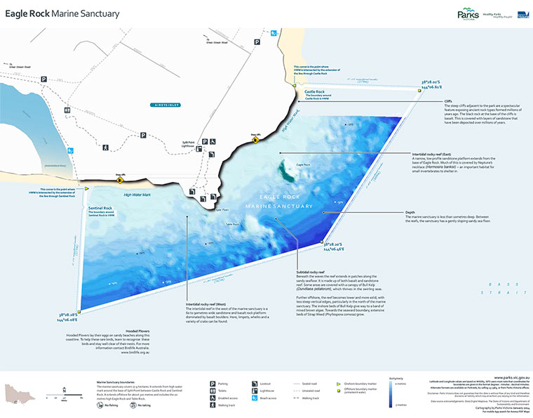
A narrow, low profile sandstone platform extends from the base of Eagle Rock. Much of this is covered by Neptune's necklace (Hormosira banksii) — an important habitat for small invertebrates to shelter in. The area around Eagle Rock is relatively shallow. The area to the south and east of Table Rock is where the best diving is found.
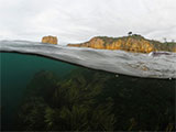
The Eagle Rock Marine Sanctuary is good for diving and snorkelling when conditions are calm. There are plenty of different fish, tunnels, swim throughs, caverns, stingrays, and crayfish to see. Most of the park is less than 10 metres deep. The offshore rocks are fringed by swirling Bull Kelp, which thrives in the breaking waves. Colourful sea-tulips and encrusting sponges grow on the rocks, and Blue-throat Wrasse, Herring Cale and Scalyfin are common fish. Watch for Banjo Sharks, Stingarees and other rays resting on the sand.
Young Port Jackson Sharks spend time in this area sheltering in rock crevices. Look for their dark brown spiralled egg cases washed up on the beach. They can be up to 15 cm long and are an interesting find. Remember to leave these where you find them.
Beneath the waves the subtidal rocky reef extends in patches along the sandy seafloor. It is made up of both basalt and sandstone reef. Some areas are covered with a canopy of Bull Kelp (Durvillaea potatorum), which thrives in the swirling seas. Further offshore, the reef becomes lower and more solid, with less steep vertical edges, particularly in the north of the marine sanctuary. The inshore beds of Bull Kelp give way to a band of mixed brown algae. Towards the seaward boundary, extensive beds of Strap Weed (Phyllospora comosa) grow.
The intertidal rocky reef in the west of the marine sanctuary is a 60 to 90 metres wide sandstone and basalt rock platform dominated by basalt boulders. Here, limpets, whelks and a variety of crabs can be found. The intertidal reef of Table and Eagle rock provides an occasional haul-out area for Australian Fur Seals.
The Eagle Rock Marine Sanctuary covers 17.9 hectares. It extends from high water mark around the base of Split Point between Castle Rock and Sentinel Rock. It extends offshore for about 300 metres and includes the 20 metre high Eagle Rock and Table Rock. The marine sanctuary is less than 10 metres deep. Between the reefs, the sanctuary has a gently sloping sandy sea floor.
Location: Aireys Inlet, Victoria 3231
How To Get There: Eagle Rock Marine Sanctuary is located in Aireys Inlet, a small coastal town on the Great Ocean Road approximately 125 km west from Melbourne and 48 km south-west of Geelong. Access to the south west beach at Painkalac Creek is via Inlet Crescent. Access to the north east beach is from the cliff top lookouts at the Split Point Lighthouse visitors' car park in Federal Street, down stairs onto Step Beach.
Warning: This is a hazardous area as it can be prone to strong surging swells, wind and poor visibility. It should only be considered for diving and snorkelling in safe conditions with low waves and small to no swell. When calm the dive site is safe, but stay alert for rogue waves coming in off Bass Strait. Beware of strong current and undertows when snorkelling, or at the beach.
Entry/Exit: The south-western entry point is via the beach on the eastern site of the entrance to Painkalac Creek, south of Inlet Crescent, and west of the Split Point Lighthouse.
The north-easterly entry point is from Step Bach accessed from Federal Street, north of the Split Point Lighthouse and Castle Rock.
Ideal Conditions:The more favorable conditions are light north to north west winds, with small to no swell. Avoid diving here if there has been any easterly swell or easterly wind on previous consecutive days.
See WillyWeather (Split Point Lighthouse) as a guide for the tide times and the height of the tide.
Prevailing winds and swells are generally from the south-west in winter and south-east in spring/summer. The sanctuary is influenced by high energy waves and the associated movement of sand. Tidal variation is 1.7 metres for spring tides and 0.9 metres for neap tides. Surface water temperatures average 17.5° C in the summer and 13.5° C in the winter.
Bass Strait Warning: Always keep an eye on sea conditions throughout any shore or boat dive in Bass Strait on Victoria's coastline. Please read the warnings on the web page diving-in-bass-strait before diving or snorkelling this site.
See, Park Note: Eagle Rock Marine Sanctuary,
Friends of Eagle Rock Marine Sanctuary (Facebook Group),
Parks Victoria: Eagle Rock Marine Sanctuary, and
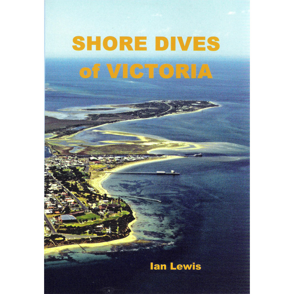
Airey's Inlet... ...Split Point and Eagle Rock in "Shore Dives of Victoria" by Ian Lewis, 3rd edition pages 32–33.
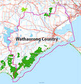
Traditional Owners — This dive site is in the traditional Country of the Wathaurong (Wadda-Warrung) people of the Kulin Nation. This truly ancient Country includes the coastline of Port Phillip, from the Werribee River in the north-east, the Bellarine Peninsula, and down to Cape Otway in the south-west. We wish to acknowledge the Wathaurong as Traditional Owners. We pay respect to their Ancestors and their Elders, past, present and emerging. We acknowledge Bunjil the Creator Spirit of this beautiful land, who travels as an eagle, and Waarn, who protects the waterways and travels as a crow, and thank them for continuing to watch over this Country today and beyond.
Eagle Rock, Aireys Inlet Location Map
Latitude: 38° 28.131′ S (38.468844° S / 38° 28′ 7.84″ S)
Longitude: 144° 6.117′ E (144.101953° E / 144° 6′ 7.03″ E)
Datum: WGS84 |
Google Map
| Get directions
Added: 2022-01-22 18:52:18 GMT, Last updated: 2022-05-03 16:33:09 GMT
Source: Google Earth
Nearest Neighbour: Sandy Gully Beach, 1,367 m, bearing 42°, NE
Eagle Rock Marine Sanctuary.
Aireys Inlet, Surf Coast.
Depth: 1 to 10 m.
[ Top ]
DISCLAIMER: No claim is made by The Scuba Doctor as to the accuracy of the dive site coordinates listed here. Should anyone decide to use these GPS marks to locate and dive on a site, they do so entirely at their own risk. Always verify against other sources.
The marks come from numerous sources including commercial operators, independent dive clubs, reference works, and active divers. Some are known to be accurate, while others may not be. Some GPS marks may even have come from maps using the AGD66 datum, and thus may need be converted to the WGS84 datum. To distinguish between the possible accuracy of the dive site marks, we've tried to give each mark a source of GPS, Google Earth, or unknown.





![Halcyon Infinity 30lb System [SS Small Backplate] Halcyon Infinity 30lb System [SS Small Backplate]](/diveshop/images/halcyon/Halcyon-Evolve-Wing.jpg)


