Navigation
Professional Masks
We have been told by our suppliers that we sell more corrective lens mask than the whole of the rest of the Australian dive industry combined. It's because of the detailed information on this web page, plus our excellent customer service and everyday low prices. Please read the following information carefully. Then join the thousands of divers and snorkellers who are seeing clearly underwater using a corrective lens mask from The Scuba Doctor.
Prescription vs Corrective Lens Masks
If you wear prescription glasses, diving and snorkelling masks fitted with lenses with your exact prescription can be obtained. But it's very expensive and time consuming. Most divers and snorkellers don't require this expensive solution and their needs can be solved with less expensive and quick to obtain corrective lens mask solutions. The important thing here is to make sure that the variety of your needs are taken into consideration and the right solution is chosen.
If you are a snorkeller you probably just need to see objects in the distance, therefore a distance only correction lens can be used with selected masks. That's the case for many divers as well. The solution is what we call a negative corrective lens mask — a negative correction to the whole lens, for short/near-sighted people with myopia.
For some scuba divers and snorkelers it's the reverse and and they need positive correction lenses for near vision issues. The solution is what we call a positive corrective lens mask — a positive correction to the whole lens, for long/far-sighted people with hypermetropia.
Some scuba divers just need a bit of help reading their gauges, dive computers, or camera controls. The solution is what we call a 'bifocal', or gauge reading, corrective lens mask — clear or planar on top and a lower pane with positive correction for reading.
Sometimes snorkellers and scuba divers have eye shapes that require lens shapes not available with corrective lenses. They need a full prescription lens mask solution, and we can't provide it.
Also, some divers may need both distance correction to see the underwater life, and near correction to read gauges and dive computers. Therefore, depending on your prescription, true bifocal, or truncated, full prescription lenses may be required — distance correction on top and a lower pane with positive correction for reading. This is what we call a full bifocal prescription lens mask solution, and we can't provide it.
Your optometrist is the best person to advise you as to which of the above solutions are right for you. Please show them this web page so that they can understand what we can and can't do. Then they can give you the right and left eye correction values we need to provide your underwater vision solution.
Diving/Snorkelling Mask Corrective Lenses
The Scuba Doctor is able to provide the dive and snorkelling masks listed here already fitted with pre-made corrective lenses that correct close to your prescription, not exact. This is a good solution for most scuba divers and snorkellers with low astigmatism.

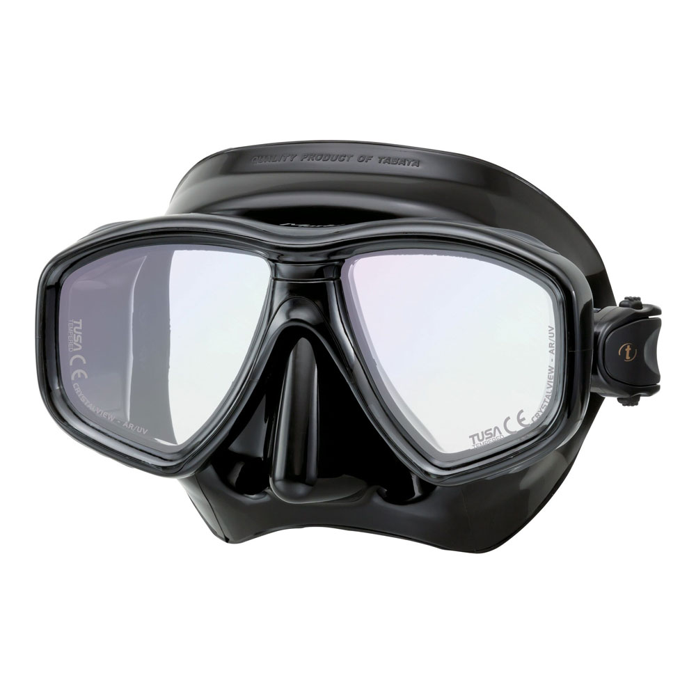
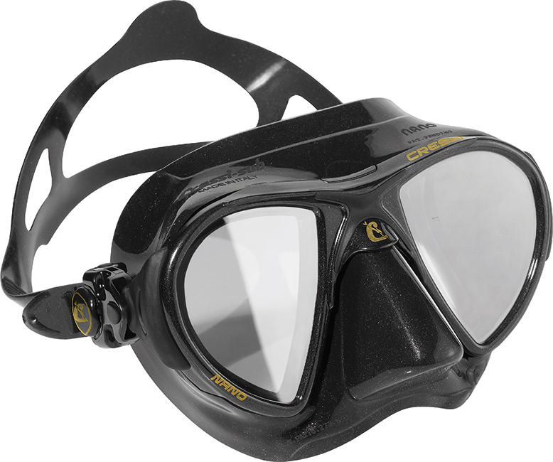
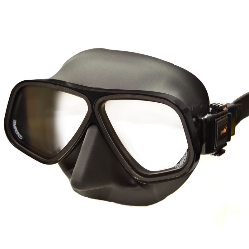
Corrective lens mask: the mask, plus two separate correction lenses.
Supplied with the corrective lenses fitted, plus the original normal lenses.
We can offer dive masks in a range of correction strengths to suit most people. We offer positive and negative corrections and bifocals. Bifocals are great for people who are long sighted and just struggle to view their gauges. The lenses we supply are not the stick on type, they are complete replacements for the current lenses. We can therefore only supply these on a select few masks.
Some of the masks with optional vision correcting lenses can be obtained with either a '-' (minus/negative) dioptre (e.g. -1.5 to -9.0), or a '+' (plus/positive) dioptre (e.g. +1.0 to +4.5), typically in 0.5 increments.
Some divers require negative distance vision correction, that is, the diver has 'near-sightedness' and the Rx Sphere value is a '-' dioptre.
Other divers require a positive correction, that is, the diver has 'far-sightedness' and the Rx Sphere value is a '+' dioptre.
To order, you can consult your eyeglass, or contact, prescription for the proper amount of spherical power correction. A spectacle prescription is usually written in the following form:
| sphere | cylinder | axis | |||
| OD / R | -3.00 | / | -0.50 | x | 180 |
| OS / L | -3.50 | / | -1.00 | x | 180 |
In order to calculate the power you need to take into account the two aspects of your prescription.
- The sphere (or sph) is the main part of your prescription and will be '–' for short-sightedness (myopia) and '+' for long-sightedness (hypermetropia).
- The cylinder (or cyl) is the secondary part of your prescription and refers to the amount of astigmatism you have.
We need the dioptre (diopter) value. When reading your prescription, 'OS' means your left eye, and 'OD' means your right eye. If you have a quarter dioptre prescription, then you should typically increase to the next higher/stronger dioptre. For example, if the Rx is -1.75, then increase to -2.0 dioptre. If the Rx is +1.75, then increase to +2.0 dioptre. If one eye needs no correction, then order a 'Normal' or 'Plano' lens for that side.
The decision about the values you need is best done by your optometrist as they know best what's going on with your eyes, and sometimes those other values in your script come into play.
Once you know the dioptre values you need, you can then select a mask for which the range or dioptre values available matches your requirements.Bifocal or 'Gauge Reader' Corrective Lenses
 Finding the numerals on your gauge too small, especially in the dark? Finding your arm is not long enough, but have pretty good distance vision? If you answered yes to these questions, then you probably have presbyopia, a condition where the eye exhibits a progressively diminished ability to focus on near objects with age. On the surface the fix is reading glasses (those things you always forget just when you need them most). Bright light also helps, as it constricts the pupils, and decreases spherical aberration. Some people use prescription bifocals, trifocals or multi-focal lenses.
Underwater the solution is a 'Gauge Reader' mask fitted with what the dive industry refers to as Bifocal corrective lenses. These underwater bifocal corrective lenses for masks aren't quite what people are used to with bifocal prescription glasses.
With Gauge Reader dive mask bifocal corrective lenses, the lower pane (roughly a third) has the plus dioptre reading correction, and the rest of the lens is 'Normal' or 'Plano'. That's why they're referred to as Gauge Reading lenses. You need to know the dioptre value for your reading glasses.

Bifocal lens mask with gauge reading correction lenses.
Normal (plano) vision for top two thirds and "reading" (plus) correction for bottom third.
Supplied with the bifocal lenses fitted, plus the original normal (plano) lenses.
Bifocal / Gauge Reading corrective lenses are typically available in a dioptre range of +1.0 to +4.5, in 0.5 increments. If you have a quarter dioptre prescription, then increase to the next higher/stronger dioptre. Your eyes will inevitably change and within a few years you will need the stronger dioptre. Now you can select a mask which has Bifocal / Gauge Reader corrective lenses available with the dioptre value(s) you need.
Note: The bifocal correcting mask lenses we sell have the reading correction attached via a permanent bond by the lens manufacturer. The correction is not an after-market 'stick on' or 'glue in' lens that is not permanent. Our own experience, plus that of our customers, very plainly tells us that none of the after-market 'stick-on' solutions work well, and thus we don't bother selling them.
Please note that all of the masks listed here can have corrective lenses fitted, but only a few of the masks can have bifocal, gauge reading corrective lenses fitted.
What Corrections Do We Offer?
We offer the following levels of prescription/correction, in half dioptre increments:
- Minus lenses from -1.0 to -9.0*
- Plus lenses from +1.0 to +4.5*
- Bifocal lenses from +1.0 to +4.5*
* available on selected masks only.
Please Note: The scripts issued by optometrists use quarter dioptre increments. We can only provide half dioptre increments. This is another reason why you should consult your optometrist, as they will be able to come up with the values you need.
What If I Have Astigmatism?
None of the 'off the shelf' corrective lens masks correct astigmatism, so if the majority of your prescription is astigmatism, or you have astigmatism over 2.00 dioptres, you will need a custom made product for best visual results.
If your astigmatism is less than 2.00 dioptres, or is not the majority of correction, then the corrective lens mask solutions we can provide should be fine. This is another reason why you should consult your optometrist.
Please Consult Your Optometrist
We strongly recommend that you consult your optometrist about which underwater vision correction solution is best for you. We recommend you show them this information. Your optometrist will be able to work out which corrective solutions are available to you and make recommendations as to what to get, plus provide the two dioptre values we need.
We are not optometrists and can't read your script to determine if a corrective lens mask will work for you. Correction lenses typically will work for the vast majority of people, but some eye shapes can't be accommodated this way.
Your prescription may need to be changed, because the distance between the lens of your diving mask and your eyes typically is different from the distance between your eyeglasses lenses and your eyes. (This also is one of the reasons your contact lens prescription is different from your eyeglass prescription if you have moderate or high myopia.) An eye care professional specialising in sports eye wear can adjust your prescription for underwater use.
Your optometrist will also be able to provide you with the best spherical correction dioptre values for your left and right eyes given the half dioptre increments of corrective lenses. Then you can order your corrective lens mask from The Scuba Doctor with confidence in achieving a great outcome.
Whatever your preference, there are plentiful corrective options available to ensure that everyone can see clearly to experience the beauty and wonder of the underwater world.
Recommended Optometrist:
Melbourne: David Glennie is an optometrist and experienced scuba diver. His team can check your eyes and translate your script into the values we need for your corrective lenses. They can even show you how it will work.
David Glennie, Karingal Optical
Shop 39, Karingal Hub, 330 Cranbourne Road, Frankston VIC 3199
Tel. 03 9789 4811 www.facebook.com/KaringalOptical/
Fitting the Mask Corrective Lenses
If you buy a complete mask with two corrective lenses from The Scuba Doctor, we will fit the lenses to the mask for you before sending the mask out. You will also receive the original normal (plano) lenses, placed inside the packets the corrective lenses came in.
Corrective Lens Mask Delivery
Order today and your mask with corrective lenses will be assembled and usually Ship the next Business Day.
We typically place orders for your mask with corrective lenses with our suppliers the same day we receive the order from you. In some cases they will be assembled and shipped direct to you from the suppliers the same business day, or if not, the next business day. Our suppliers are Sydney based, so you need to allow for the usual postal delivery times for the package to reach you from Sydney.
Colour Options: Many of the masks are available with heaps of colour choices. However, sometimes our suppliers get low on some colour options. Please enter any other mask colour options you'd be happy with in the comments during the checkout process. Then we have options to switch to so that your order isn't delayed.
Other Considerations
Custom made prescription lenses made to your exact prescription are sometimes preferred by more advanced divers, for those shooting underwater photo/video, or those who need a bifocal lens with two different types of correction in each lens. We suggest you try Ozbob Scuba for custom made prescription scuba masks.
Because you asked... the negative and positive vision correcting mask lenses we sell have the magnification ground into the lenses themselves. The bifocal gauge reading correction is attached via a permanent bond by the lens manufacturer. The correction is not an after-market 'stick on' or 'glue in' lens that is not permanent. Our own experience, plus that of our customers, very plainly tells us that none of the after-market 'stick-on' solutions work well, and thus we don't sell them.
Contact Lens Wearers: Not all contact lenses are suitable for diving. Gas permeable lenses (GP lenses) can 'dig' into the eyes below certain depths, because of the pressure. Soft contact lenses can collect waterborne organisms and become contaminated, causing eye infections. If you wear contact lenses under your mask for diving, you need to make sure you blink a lot. Excessive starring can cause bubbles to form underneath your lenses and which may cause minor discomfort and temporary blurring of vision. Also be sure to have a spare set of contacts (or glasses) available in case you lose a contact underwater.
Health Fund Refunds
As best as we can tell, you will be unable to claim for a refund from your health fund for the supply of a corrective lens mask. Most health funds require a medical provider item code for a claim to be successful and no dive manufacturer or dive shop we know of has this. However, you may wish to check with your health fund to see if they are more generous.
More Information
For more information please see our Scuba Buying Guides: Buying a Great Dive Mask and Avoiding Mask Squeeze, plus our Dive Gear Features pages: Mask Features and Fixing Underwater Vision Problems.
Note: Diving/snorkelling masks are very different to Swimming Goggles. See Goggles vs Masks.
Victorian Ships Graveyard Wreck Dives
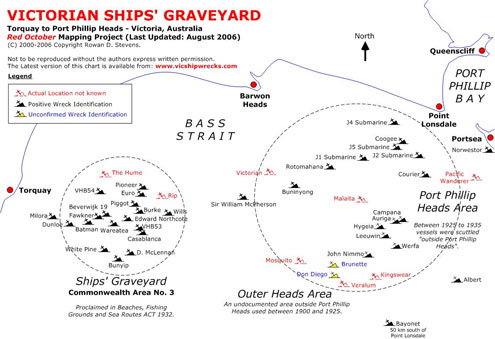
South of Melbourne there is a Ships' Graveyard. It's located 7 kilometres (4.35 miles) east of Torquay's Fisherman's Beach through to Point Lonsdale. There are 46 known wrecks to choose from. They consist of tugs, dredges, barges, lighters, coastal freighter, World War One submarines, a paddle steamer plus a patrol boat. Many of these vessels were stripped down and scuttled by an explosive charge or an opened valve cock, and many remain fairly intact to this day.
There are two areas that make up Victoria's Ships' Graveyard:
- Outer Heads Area: An undocumented area outside Port Phillip Heads used between 1900 and 1925. It was the lack of discipline in the use of this area that caused an official area to be created. Back in the day they would take hulks to be scuttled out to the area, open the sea cocks and set them adrift, sometimes even ablaze. The result was some vessels drifted and ended up all over the place. The hulk of the 567-ton barque Norwester ended up on the popular tourist beach at Portsea in November 1928. Public outcry at such mishaps saw the introduction of sea dumping legislation.
- Commonwealth Area No. 3: This is the designated Victorian zone for sea dumping of obsolete vessels. Proclaimed in Beaches, Fishing Grounds and Sea Routes ACT 1932, this is the official Ships' Graveyard. Area #3 is 6 kilometres in diameter and ranges in depth from 40 to 60 metres and is located approximately 10 kilometres south west of Barwon Heads.
These vessels were decommissioned from the early 1900s through to 1999 and range in depth from 30 metres (98 feet) to 82 metres (269 feet). Penetration can be had on some wrecks, and there is little tidal current or shipping to be concerned with so wrecks can be dived at any time of the day. The main constraints are wind strength and the size of the swell.
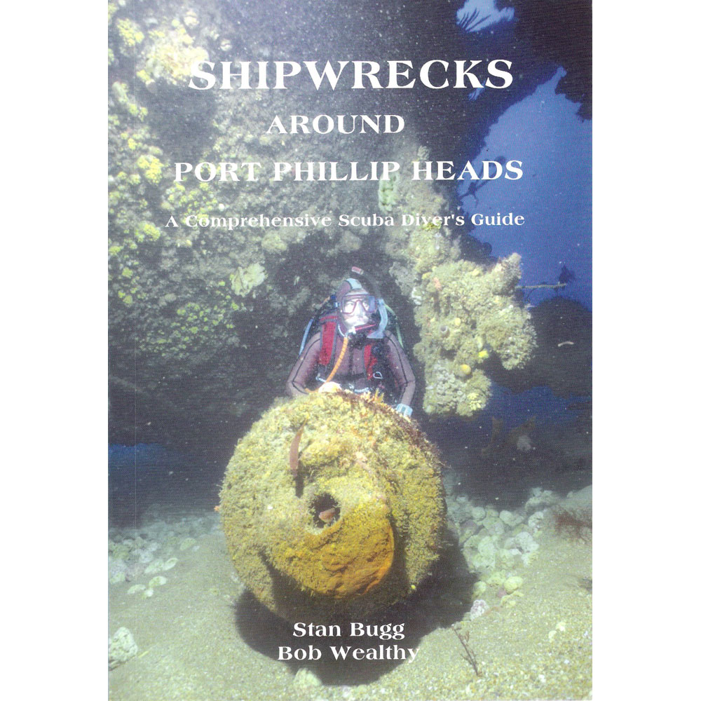
The best reference work on these wrecks is:
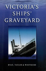
"Victoria's Ships' Graveyard"
Authors: Mark Ryan, Peter Taylor & Mick Whitmore
Published: 2009 by Scuttlebutt Press
ISBN: 9780980590203
Status: Out of print.
All shipwrecks in the Victorian Ships' Graveyard are protected.
Any persons contravening the Heritage Act (1995) may face severe penalties as a result.
Alert | Wreck Dive | Boat access |
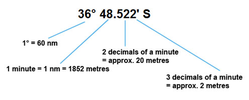
| Latitude: 38° 29.217′ S (38.486944° S / 38° 29′ 13″ S) Longitude: 144° 45.033′ E (144.750556° E / 144° 45′ 2″ E) | ||
| Datum: WGS84 | Google Map | |
| Added: 2012-07-22 01:00:00 GMT, Last updated: 2022-05-18 03:02:08 GMT Source: Victorian Government GPS (verified) | ||
| Nearest Neighbour: Cape Schanck Cray Reef, 10,320 m, bearing 81°, E | ||
| Historic shipwreck protected zone. Permit Required. Iron Screw Steamer. Built: Glasgow, Scotland, 1877. Sunk: 28 December 1893. Victorian Ships' Graveyard, Cape Schanck, Bass Strait. Depth: 75 m. | ||
| See the Alert dive site page | ||
Auriga | Wreck Dive | Boat access |
| Latitude: 38° 20.771′ S (38.346175° S / 38° 20′ 46.23″ S) Longitude: 144° 34.210′ E (144.570168° E / 144° 34′ 12.6″ E) | ||
| Datum: WGS84 | Google Map | |
| Added: 2012-07-22 01:00:00 GMT, Last updated: 2022-05-03 14:39:26 GMT Source: Book - Victoria's Ships' Graveyard GPS (verified) | ||
| Nearest Neighbour: Campana, 178 m, bearing 209°, SSW | ||
| Three-Masted Iron Barque, 540 ton. Built: Sunderland, UK, 1869. Scuttled: 5 February 1930. Victorian Ships' Graveyard, Bass Strait. Depth: 55 to 57 m. | ||
| See the Auriga dive site page | ||
Batman | Wreck Dive | Boat access |
| Latitude: 38° 21.306′ S (38.3551° S / 38° 21′ 18.36″ S) Longitude: 144° 24.659′ E (144.410983° E / 144° 24′ 39.54″ E) | ||
| Datum: WGS84 | Google Map | |
| Added: 2012-07-22 01:00:00 GMT, Last updated: 2022-05-18 03:04:16 GMT Source: Book - Victoria's Ships' Graveyard GPS (verified) | ||
| Nearest Neighbour: Dunloe, 667 m, bearing 261°, W | ||
| Steam Driven Iron Hopper Barge, 388 ton. Built: Renfrew, Scotland, 1883. Scuttled: 21 May 1935. Victorian Ships' Graveyard, Bass Strait. Depth: 42 to 46 m. | ||
| See the Batman dive site page | ||
Bayonet | Wreck Dive | Boat access |
| Latitude: 38° 43.050′ S (38.7175° S / 38° 43′ 3″ S) Longitude: 144° 35.250′ E (144.5875° E / 144° 35′ 15″ E) | ||
| Datum: WGS84 | Google Map | |
| Added: 2012-07-22 01:00:00 GMT, Last updated: 2022-05-03 18:26:01 GMT Source: GPS | ||
| Nearest Neighbour: Helen, 25,482 m, bearing 63°, ENE | ||
| Attack Class Patrol Boat, 150 ton. Built: Queensland, 1968. Sunk: 21 September 1999. Victorian Ships' Graveyard, Bass Strait. Depth: 82 m. | ||
| See the Bayonet dive site page | ||
Beverwijk 19 | Wreck Dive | Boat access |
| Latitude: 38° 21.120′ S (38.352° S / 38° 21′ 7.2″ S) Longitude: 144° 25.171′ E (144.419517° E / 144° 25′ 10.26″ E) | ||
| Datum: WGS84 | Google Map | |
| Added: 2012-07-22 01:00:00 GMT, Last updated: 2022-05-03 18:38:52 GMT Source: Book - Victoria's Ships' Graveyard GPS (verified) | ||
| Nearest Neighbour: Victorian, 226 m, bearing 10°, N | ||
| Steam Dredge, 319 ton. Built: 1912. Scuttled: 7 May 1963. Victorian Ships' Graveyard, Bass Strait. Depth: 42 to 46 m. | ||
| See the Beverwijk 19 dive site page | ||
Birchgrove
Barque, Lighter
Built in 1856 and scuttled on 8 February 1932, the overall length of the vessel was approximately 41.67 metres (137 feet), beam 8.6 metres (28 feet) and draught 5.7 metres (19 feet) with a displacement weight of 470 tonnes (518 short tons(US)).
Location: Nobbies, Phillip Island
See also, Australian National Shipwreck Database: Birchgrove, and
Heritage Council Victoria: Birchgrove.
Brunette | Wreck Dive | Boat access |
| Latitude: 38° 22.341′ S (38.372351° S / 38° 22′ 20.46″ S) Longitude: 144° 32.006′ E (144.533428° E / 144° 32′ 0.34″ E) | ||
| Datum: WGS84 | Google Map | |
| Added: 2012-07-22 01:00:00 GMT, Last updated: 2022-05-04 00:24:32 GMT Source: Book - Victoria's Ships' Graveyard GPS (verified) | ||
| Nearest Neighbour: John Nimmo, 2,213 m, bearing 62°, ENE | ||
| Three-Masted Iron Barque, Coal Hulk, 382 ton. Built: Deptford, UK, 1859. Scuttled: July 1913. Victorian Ships' Graveyard, Bass Strait. Depth: 70 m. | ||
| See the Brunette dive site page | ||
Buninyong | Wreck Dive | Boat access |
| Latitude: 38° 20.224′ S (38.337072° S / 38° 20′ 13.46″ S) Longitude: 144° 31.041′ E (144.517342° E / 144° 31′ 2.43″ E) | ||
| Datum: WGS84 | Google Map | |
| Added: 2012-07-22 01:00:00 GMT, Last updated: 2022-04-28 07:36:11 GMT Source: Book - Victoria's Ships' Graveyard GPS (verified) | ||
| Nearest Neighbour: Rotomahana, 2,520 m, bearing 40°, NE | ||
| Steel Hulled Steamship, 2076 ton. Built: Barrow-in-Furness, UK, 1883. Scuttled: 11 February 1926. Victorian Ships' Graveyard, Bass Strait. Depth: 50 to 54 m. | ||
| See the Buninyong dive site page | ||
Bunyip | Wreck Dive | Boat access |
| Latitude: 38° 22.305′ S (38.371758° S / 38° 22′ 18.33″ S) Longitude: 144° 25.563′ E (144.426057° E / 144° 25′ 33.81″ E) | ||
| Datum: WGS84 | Google Map | |
| Added: 2012-07-22 01:00:00 GMT, Last updated: 2022-05-04 06:46:11 GMT Source: Book - Victoria's Ships' Graveyard GPS (verified) | ||
| Nearest Neighbour: D McLennan, 716 m, bearing 58°, ENE | ||
| Steam Driven Iron Dredge, 317 ton. Built: Renfrew, Scotland, 1879. Scuttled: 13 April 1955. Victorian Ships' Graveyard, Bass Strait. Depth: 58 m. | ||
| See the Bunyip dive site page | ||
Burke | Wreck Dive | Boat access |
| Latitude: 38° 20.999′ S (38.349987° S / 38° 20′ 59.95″ S) Longitude: 144° 25.982′ E (144.433037° E / 144° 25′ 58.93″ E) | ||
| Datum: WGS84 | Google Map | |
| Added: 2012-07-22 01:00:00 GMT, Last updated: 2022-05-04 07:16:21 GMT Source: Book - Victoria's Ships' Graveyard GPS (verified) | ||
| Nearest Neighbour: Euro, 500 m, bearing 19°, NNE | ||
| Steam Hopper Barge, 345 ton. Built: Adelaide, South Australia, 1876. Scuttled: 23 September 1935. Victorian Ships' Graveyard, Bass Strait. Depth: 50 m. | ||
| See the Burke dive site page | ||
Campana | Wreck Dive | Boat access |
| Latitude: 38° 20.854′ S (38.347567° S / 38° 20′ 51.24″ S) Longitude: 144° 34.150′ E (144.569167° E / 144° 34′ 9″ E) | ||
| Datum: WGS84 | Google Map | |
| Added: 2012-07-22 01:00:00 GMT, Last updated: 2022-05-04 08:06:41 GMT Source: Book - Victoria's Ships' Graveyard GPS (verified) | ||
| Nearest Neighbour: Auriga, 178 m, bearing 29°, NNE | ||
| Three-Masted Iron Barque, 815 ton. Built: Liverpool, England, 1875. Scuttled: 30 July 1927. Victorian Ships' Graveyard, Bass Strait. Depth: 54 to 56 m. | ||
| See the Campana dive site page | ||
Casablanca | Wreck Dive | Boat access |
| Latitude: 38° 21.777′ S (38.362953° S / 38° 21′ 46.63″ S) Longitude: 144° 26.332′ E (144.438867° E / 144° 26′ 19.92″ E) | ||
| Datum: WGS84 | Google Map | |
| Added: 2012-07-22 01:00:00 GMT, Last updated: 2022-05-04 08:45:13 GMT Source: Book - Victoria's Ships' Graveyard GPS (verified) | ||
| Nearest Neighbour: VHB 53, 298 m, bearing 325°, NW | ||
| Three-Masted Iron Barque, Lighter, 601 ton. Built: Liverpool, England, 1868. Scuttled: 16 February 1950. Victorian Ships' Graveyard, Bass Strait. Depth: 57 m. | ||
| See the Casablanca dive site page | ||
Coogee | Wreck Dive | Boat access |
| Latitude: 38° 18.411′ S (38.30685° S / 38° 18′ 24.66″ S) Longitude: 144° 34.306′ E (144.571767° E / 144° 34′ 18.36″ E) | ||
| Datum: WGS84 | Google Map | |
| Added: 2012-07-22 01:00:00 GMT, Last updated: 2022-05-07 15:01:30 GMT Source: Packo GPS (verified) | ||
| Nearest Neighbour: J5 Yellow Submarine, 520 m, bearing 211°, SSW | ||
| Steel Hulled Steam Ship, 762 ton. Built: Sunderland, UK, 1887. Scuttled: 27 February 1928. Victorian Ships' Graveyard, Bass Strait. Depth: 28 to 34 m. Dive only on: SWF, SWE, Ebb, Flood. | ||
| See the Coogee dive site page | ||
Courier | Wreck Dive | Boat access |
| Latitude: 38° 19.488′ S (38.324797° S / 38° 19′ 29.27″ S) Longitude: 144° 34.920′ E (144.582008° E / 144° 34′ 55.23″ E) | ||
| Datum: WGS84 | Google Map | |
| Added: 2012-07-22 01:00:00 GMT, Last updated: 2022-05-01 10:23:09 GMT Source: Book - Victoria's Ships' Graveyard GPS (verified) | ||
| Nearest Neighbour: Lost Reef, 860 m, bearing 0°, N | ||
| Steel Hulled Steam Ship, 728 ton. Built: Wallsend-on-Tyne, England, 1887. Scuttled: 29 March 1929. Victorian Ships' Graveyard, Bass Strait. Depth: 37 to 42 m. Dive only on: SWF, SWE. | ||
| See the Courier dive site page | ||
D McLennan | Wreck Dive | Boat access |
| Latitude: 38° 22.104′ S (38.368392° S / 38° 22′ 6.21″ S) Longitude: 144° 25.983′ E (144.433055° E / 144° 25′ 59″ E) | ||
| Datum: WGS84 | Google Map | |
| Added: 2012-07-22 01:00:00 GMT, Last updated: 2022-05-11 19:26:34 GMT Source: Book - Victoria's Ships' Graveyard GPS (verified) | ||
| Nearest Neighbour: Bunyip, 716 m, bearing 238°, WSW | ||
| Steel Steam Bucket Dredge, 424 tons. Built: Leyden, Holland, 1912. Scuttled: 8 June 1949. Victorian Ships' Graveyard, Bass Strait. Depth: 58 m. | ||
| See the D McLennan dive site page | ||
Don Diego | Wreck Dive | Boat access |
| Latitude: 38° 23.726′ S (38.395433° S / 38° 23′ 43.56″ S) Longitude: 144° 32.055′ E (144.534253° E / 144° 32′ 3.31″ E) | ||
| Datum: WGS84 | Google Map | |
| Added: 2012-07-22 01:00:00 GMT, Last updated: 2022-05-11 20:07:26 GMT Source: Book - Victoria's Ships' Graveyard GPS (verified) | ||
| Nearest Neighbour: Brunette, 2,568 m, bearing 358°, N | ||
| Three-Masted Iron Barque, Coal Hulk, 320 ton. Built: Greenock, UK, 1855. Scuttled: 26 May 1916. Victorian Ships' Graveyard, Bass Strait. Depth: 70 to 72 m. | ||
| See the Don Diego dive site page | ||
Dunloe | Wreck Dive | Boat access |
| Latitude: 38° 21.360′ S (38.356° S / 38° 21′ 21.6″ S) Longitude: 144° 24.205′ E (144.403417° E / 144° 24′ 12.3″ E) | ||
| Datum: WGS84 | Google Map | |
| Added: 2012-07-22 01:00:00 GMT, Last updated: 2022-05-12 02:27:12 GMT Source: Book - Victoria's Ships' Graveyard GPS (verified) | ||
| Nearest Neighbour: Batman, 667 m, bearing 81°, E | ||
| Three-Masted Iron Barque, 704 ton. Built: Glasgow, Scotland, 1870. Scuttled: 2 July 1947. Victorian Ships' Graveyard, Bass Strait. Depth: 44 to 46 m. | ||
| See the Dunloe dive site page | ||
Edward Northcote | Wreck Dive | Boat access |
| Latitude: 38° 21.369′ S (38.356157° S / 38° 21′ 22.17″ S) Longitude: 144° 25.799′ E (144.429983° E / 144° 25′ 47.94″ E) | ||
| Datum: WGS84 | Google Map | |
| Added: 2012-07-22 01:00:00 GMT, Last updated: 2022-05-12 16:04:43 GMT Source: Book - Victoria's Ships' Graveyard GPS (verified) | ||
| Nearest Neighbour: Wareatea, 422 m, bearing 101°, E | ||
| Steam Hopper Barge, 495 ton. Built: Paisley, Scotland, 1911. Scuttled: 6 November 1952. Victorian Ships' Graveyard, Bass Strait. Depth: 52 m. | ||
| See the Edward Northcote dive site page | ||
Euro | Wreck Dive | Boat access |
| Latitude: 38° 20.744′ S (38.345738° S / 38° 20′ 44.66″ S) Longitude: 144° 26.094′ E (144.434905° E / 144° 26′ 5.66″ E) | ||
| Datum: WGS84 | Google Map | |
| Added: 2012-07-22 01:00:00 GMT, Last updated: 2022-05-12 15:59:25 GMT Source: Book - Victoria's Ships' Graveyard GPS (verified by Ian Scholey, VSAG) | ||
| Nearest Neighbour: H.C. Piggot, 434 m, bearing 66°, ENE | ||
| Steam Tug, 257 ton. Built: Dundee, Scotland, 1897. Scuttled: 10 June 1948. Victorian Ships' Graveyard, Bass Strait. Depth: 44 to 50 m. | ||
| See the Euro dive site page | ||
Fawkner | Wreck Dive | Boat access |
| Latitude: 38° 21.378′ S (38.3563° S / 38° 21′ 22.68″ S) Longitude: 144° 25.310′ E (144.421833° E / 144° 25′ 18.6″ E) | ||
| Datum: WGS84 | Google Map | |
| Added: 2012-07-22 01:00:00 GMT, Last updated: 2022-05-18 03:04:57 GMT Source: Book - Victoria's Ships' Graveyard GPS (verified) | ||
| Nearest Neighbour: Beverwijk 19, 519 m, bearing 337°, NNW | ||
| Steam Driven Hopper Barge, 388 ton. Built: Renfrew, Scotland, 1883. Scuttled: 20 May 1935. Victorian Ships' Graveyard, Bass Strait. Depth: 44 to 46 m. | ||
| See the Fawkner dive site page | ||
Helen | Wreck Dive | Boat access |
| Latitude: 38° 36.900′ S (38.615° S / 38° 36′ 54″ S) Longitude: 144° 51.000′ E (144.85° E / 144° 51′ E) | ||
| Datum: WGS84 | Google Map | |
| Added: 2019-03-11 05:48:07 GMT, Last updated: 2022-05-01 22:51:31 GMT Source: Australasian Underwater Cultural Heritage Database (approximate location only) | ||
| Nearest Neighbour: Cape Schanck West, 13,596 m, bearing 13°, NNE | ||
| Three-Masted Composite Barque. Built: 1864. Sunk: 10 March 1938. Victorian Ships' Graveyard, Bass Strait. Depth: 75 m. | ||
| See the Helen dive site page | ||
H.C. Piggot | Wreck Dive | Boat access |
| Latitude: 38° 20.651′ S (38.344183° S / 38° 20′ 39.06″ S) Longitude: 144° 26.368′ E (144.439467° E / 144° 26′ 22.08″ E) | ||
| Datum: WGS84 | Google Map | |
| Added: 2012-07-22 01:00:00 GMT, Last updated: 2022-05-12 16:02:52 GMT Source: Book - Victoria's Ships' Graveyard GPS (verified) | ||
| Nearest Neighbour: Euro, 434 m, bearing 246°, WSW | ||
| Steam Driven Hopper Barge, 495 ton. Built: Paisley, Scotland, 1911. Scuttled: 14 October 1935. Victorian Ships' Graveyard, Bass Strait. Depth: 46 to 48 m. | ||
| See the H.C. Piggot dive site page | ||
Hume
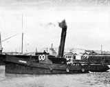
Steam Tug — Graveyard
The Hume steam tug was built in 1922 in Dordrecht, Holland and bought by the Melbourne Harbor Trust in 1925.
Location: Ship's Graveyard
Built in 1922 and scuttled in the 1950's, the overall length of the vessel was approximately 18 metres (59 feet), beam 4.7 metres (15 feet) and draught 2 metres (6.56 feet) with a displacement weight of 43 tonnes (47 short tons(US)).
Hygeia | Wreck Dive | Boat access |
| Latitude: 38° 21.017′ S (38.350275° S / 38° 21′ 0.99″ S) Longitude: 144° 33.633′ E (144.560548° E / 144° 33′ 37.97″ E) | ||
| Datum: WGS84 | Google Map | |
| Added: 2012-07-22 01:00:00 GMT, Last updated: 2022-05-14 04:03:12 GMT Source: Book - Victoria's Ships' Graveyard GPS (verified) | ||
| Nearest Neighbour: Leeuwin, 346 m, bearing 127°, SE | ||
| Steel Passenger Paddle Steamer, 986 tons. Built: Yorker (Glasgow), Scotland, 1890. Scuttled: 10 June 1932. Victorian Ships' Graveyard, Bass Strait. Depth: 58 to 62 m. | ||
| See the Hygeia dive site page | ||
J1 Deep Submarine | Wreck Dive | Boat access |
| Latitude: 38° 18.959′ S (38.315988° S / 38° 18′ 57.56″ S) Longitude: 144° 33.219′ E (144.553648° E / 144° 33′ 13.13″ E) | ||
| Datum: WGS84 | Google Map | |
| Added: 2012-07-22 01:00:00 GMT, Last updated: 2022-04-28 07:49:27 GMT Source: Book - Victoria's Ships' Graveyard GPS (verified) | ||
| Nearest Neighbour: New Deep Bommie, 1,157 m, bearing 101°, E | ||
| J-Class Submarine, 1820 ton. Built: Portsmouth, UK, 1915/1916. Scuttled: 26 May 1926. Victorian Ships' Graveyard, Bass Strait. Depth: 31 to 38 m. | ||
| See the J1 Deep Submarine dive site page | ||
J2 Broken Submarine | Wreck Dive | Boat access |
| Latitude: 38° 18.814′ S (38.31357° S / 38° 18′ 48.85″ S) Longitude: 144° 34.803′ E (144.580048° E / 144° 34′ 48.17″ E) | ||
| Datum: WGS84 | Google Map | |
| Added: 2012-07-22 01:00:00 GMT, Last updated: 2022-04-28 07:49:55 GMT Source: Book - Victoria's Ships' Graveyard GPS (verified) | ||
| Nearest Neighbour: Lost Reef, 430 m, bearing 154°, SSE | ||
| J-Class Submarine, 1820 ton. Built: Portsmouth, UK, 1915/1916. Scuttled: 1 June 1926. Victorian Ships' Graveyard, Bass Strait. Depth: 31 to 39 m. | ||
| See the J2 Broken Submarine dive site page | ||
J4 26m Submarine | Wreck Dive | Boat access |
| Latitude: 38° 17.979′ S (38.299657° S / 38° 17′ 58.77″ S) Longitude: 144° 33.820′ E (144.563673° E / 144° 33′ 49.22″ E) | ||
| Datum: WGS84 | Google Map | |
| Added: 2012-07-22 01:00:00 GMT, Last updated: 2022-05-07 18:46:51 GMT Source: Book - Victoria's Ships' Graveyard GPS (verified) | ||
| Nearest Neighbour: Sub Reef, 440 m, bearing 95°, E | ||
| J-Class Submarine, 1,820 ton. Built: Portsmouth, UK, 1915/1916. Scuttled: 28 April 1927. Victorian Ships' Graveyard, Bass Strait. Depth: 19 to 28 m. | ||
| See the J4 26m Submarine dive site page | ||
J5 Yellow Submarine | Wreck Dive | Boat access |
| Latitude: 38° 18.649′ S (38.310822° S / 38° 18′ 38.96″ S) Longitude: 144° 34.118′ E (144.568632° E / 144° 34′ 7.08″ E) | ||
| Datum: WGS84 | Google Map | |
| Added: 2012-07-22 01:00:00 GMT, Last updated: 2022-04-29 05:26:50 GMT Source: Book - Victoria's Ships' Graveyard GPS (verified) | ||
| Nearest Neighbour: Coogee, 520 m, bearing 31°, NNE | ||
| J-Class Submarine, 1820 ton. Built: Portsmouth, UK, 1915/1916. Scuttled: 4 June 1926. Victorian Ships' Graveyard, Bass Strait. Depth: 25 to 36 m. | ||
| See the J5 Yellow Submarine dive site page | ||
John Nimmo | Wreck Dive | Boat access |
| Latitude: 38° 21.787′ S (38.363123° S / 38° 21′ 47.24″ S) Longitude: 144° 33.355′ E (144.555922° E / 144° 33′ 21.32″ E) | ||
| Datum: WGS84 | Google Map | |
| Added: 2012-07-22 01:00:00 GMT, Last updated: 2022-05-14 08:10:31 GMT Source: Book - Victoria's Ships' Graveyard GPS (verified) | ||
| Nearest Neighbour: Malaita, 1,052 m, bearing 336°, NNW | ||
| Steam Dredge, 1,209 ton. Built: Footscray, Victoria, 1887. Scuttled: 10 August 1931. Victorian Ships' Graveyard, Bass Strait. Depth: 66 to 68 m. | ||
| See the John Nimmo dive site page | ||
Kingswear
Collier — Graveyard
The Kingswear in the earlier part of its career had been involved coastal trade in Queensland (not mentioned in Parsons, Australian Coastal Passenger Ships) and at some point arrived in Sydney.
The Kingswear was towed from Sydney to Melbourne by the tug Eagle in October 1906, where she was transformed into a floating pumping station. In this role the Kingswear was used in reclamation works at the West Melbourne Swamp, where silt from the old river bed was pumped into the swamp measuring 10 acres in extent. As the water pumped with the silt formed mini-lakes more solid material was required, and clay cut from the Coode Canal Banks was deposited in the river bed for pumping and filling. At the time this was described as "welcome news to bayside municipal councils and yachtsmen, who have for years been complaining that the silt deposited in the bay is eventually washed onto the foreshores" (Age 22/1/1907).
Location: South of Port Phillip Heads
The Kingswear was described as having been in a "rotten state" with a prodigious amount of marine fouling on her hull when finally scuttled on 14 April 1915.
See also, Australian National Shipwreck Database: Kingswear, and
Heritage Council Victoria: Kingswear.
Leeuwin | Wreck Dive | Boat access |
| Latitude: 38° 21.129′ S (38.35215° S / 38° 21′ 7.74″ S) Longitude: 144° 33.823′ E (144.563717° E / 144° 33′ 49.38″ E) | ||
| Datum: WGS84 | Google Map | |
| Added: 2012-07-22 01:00:00 GMT, Last updated: 2022-05-20 22:50:20 GMT Source: Book - Victoria's Ships' Graveyard GPS (verified) | ||
| Nearest Neighbour: Hygeia, 346 m, bearing 307°, NW | ||
| Passenger and Cargo Steamer, 580 ton. Built: Whiteinch, Scotland, 1976. Scuttled: 28 December 1932. Victorian Ships' Graveyard, Bass Strait. Depth: 62 m. | ||
| See the Leeuwin dive site page | ||
Malaita | Wreck Dive | Boat access |
| Latitude: 38° 21.267′ S (38.354444° S / 38° 21′ 16″ S) Longitude: 144° 33.067′ E (144.551111° E / 144° 33′ 4″ E) | ||
| Datum: WGS84 | Google Map | |
| Added: 2012-07-22 01:00:00 GMT, Last updated: 2022-04-28 07:52:59 GMT Source: GPS | ||
| Nearest Neighbour: Hygeia, 944 m, bearing 60°, ENE | ||
| Steel Steamship, 940 ton. Built: Grangemouth, UK, 1893. Scuttled: 20 November 1928. Victorian Ships' Graveyard, Bass Strait. Depth: 65 m. | ||
| See the Malaita dive site page | ||
Milora | Wreck Dive | Boat access |
| Latitude: 38° 21.102′ S (38.351705° S / 38° 21′ 6.14″ S) Longitude: 144° 23.378′ E (144.389632° E / 144° 23′ 22.68″ E) | ||
| Datum: WGS84 | Google Map | |
| Added: 2012-07-22 01:00:00 GMT, Last updated: 2022-05-11 05:50:30 GMT Source: Book - Victoria's Ships' Graveyard GPS (verified) | ||
| Nearest Neighbour: Dunloe, 1,293 m, bearing 111°, ESE | ||
| Steel Steamer Collier, 3347 ton. Built: Williamstown, Victoria, 1920. Scuttled: 8 March 1935. Victorian Ships' Graveyard, Bass Strait. Depth: 38 to 43 m. | ||
| See the Milora dive site page | ||
Mosquito
Iron Sailing Brig — Graveyard
The brig Mosquito arrived in Melbourne from Hong Kong on 9 November 1878. It was laid up in Saltwater Creek (Maribyrnong River) before being sold to the South Australian Coal Company who converted it to a hulk in 1880.
Location: South of Port Phillip Heads
Built in 1859 by Henderson & Sons in Renfrew, Scotland and scuttled on the 30 September 1915, the iron sailing brig Mosquito had an overall length of approximately 113.9 feet (35 metres), beam 20.2 feet (6.16 metres) and draught 12.2 feet (3.72 metres) with a displacement weight of 198 tonnes (218 short tons(US)).
See also, Heritage Council Victoria: Mosquito, and
Australian National Shipwreck Database: Mosquito.
Norwester | Wreck Dive | Boat access |
| Latitude: 38° 19.833′ S (38.330555° S / 38° 19′ 50″ S) Longitude: 144° 41.433′ E (144.690555° E / 144° 41′ 26″ E) | ||
| Datum: WGS84 | Google Map | |
| Added: 2012-07-22 01:00:00 GMT, Last updated: 2022-05-15 09:13:07 GMT Source: GPS | ||
| Nearest Neighbour: London Bridge, 151 m, bearing 52°, NE | ||
| Three-Masted Iron Barque, 567 ton. Built: Glasgow, Scotland, 1864. Sunk: 21 November 1928. Portsea, Back Beaches, Mornington Peninsula. Victorian Ships' Graveyard, Bass Strait. Depth: 2 m. | ||
| See the Norwester dive site page | ||
Palace
Three-Masted Barque — Graveyard
Originally a three-masted barque the Confederate Star, renamed Palace in 1869. Arrived Melbourne 1874. Went to New Zealand in 1878. Returned to Melbourne in 1886 and made a lighter.
The Palace and the Birchgrove were owned and operated by the Port of Melbourne Authority. In February 1932 the vessels were towed out to sea by the tug Keera for disposal. The vessels were set on fire but were carried shoreward by the wind and current and ran aground near the Nobbies on Phillip Island.
Location: Nobbies, Phillip Island
Built in 1866 in Miramichi, New Brunswick, USA and scuttled on the 10 February 1932, the Palace had an overall length of approximately 137 feet (42 metres), beam 28.2 feet (8.6 metres) and draught 12.9 feet (3.93 metres) with a displacement weight of 359 tonnes (396 short tons(US)).
See also, Heritage Council Victoria: Palace, and
Australian National Shipwreck Database: Palace.
Pioneer | Wreck Dive | Boat access |
| Latitude: 38° 20.366′ S (38.339433° S / 38° 20′ 21.96″ S) Longitude: 144° 26.378′ E (144.439633° E / 144° 26′ 22.68″ E) | ||
| Datum: WGS84 | Google Map | |
| Added: 2012-07-22 01:00:00 GMT, Last updated: 2022-05-12 17:02:12 GMT Source: Allie Beckhurst GPS (verified) | ||
| Nearest Neighbour: H.C. Piggot, 528 m, bearing 181°, S | ||
| Steel Steam Dredge, 543 ton. Built: Newark, Glasgow, Scotland, 1905. Scuttled: 9 March 1950. Victorian Ships' Graveyard, Bass Strait. Depth: 46 to 50 m. | ||
| See the Pioneer dive site page | ||
Rotomahana | Wreck Dive | Boat access |
| Latitude: 38° 19.191′ S (38.319857° S / 38° 19′ 11.49″ S) Longitude: 144° 32.167′ E (144.536123° E / 144° 32′ 10.04″ E) | ||
| Datum: WGS84 | Google Map | |
| Added: 2012-07-22 01:00:00 GMT, Last updated: 2022-05-06 16:41:54 GMT Source: Book - Victoria's Ships' Graveyard GPS (verified) | ||
| Nearest Neighbour: J1 Deep Submarine, 1,588 m, bearing 74°, ENE | ||
| Passenger and Cargo Steamer, 1777 ton. Built: Dumbarton, Scotland, 1879. Scuttled: 29 May 1928. Victorian Ships' Graveyard, Bass Strait. Depth: 35 to 39 m. | ||
| See the Rotomahana dive site page | ||
Sir William McPherson | Wreck Dive | Boat access |
| Latitude: 38° 20.697′ S (38.344957° S / 38° 20′ 41.85″ S) Longitude: 144° 29.214′ E (144.486898° E / 144° 29′ 12.83″ E) | ||
| Datum: WGS84 | Google Map | |
| Added: 2012-07-22 01:00:00 GMT, Last updated: 2022-05-15 10:59:41 GMT Source: Book - Victoria's Ships' Graveyard GPS (verified) | ||
| Nearest Neighbour: Buninyong, 2,796 m, bearing 71°, ENE | ||
| Steel Steam Dredge, 482 ton. Built: Kinderdijk, Holland, 1912. Scuttled: 12 May 1949. Victorian Ships' Graveyard, Bass Strait. Depth: 52 to 57 m. | ||
| See the Sir William McPherson dive site page | ||
VHB 53 | Wreck Dive | Boat access |
| Latitude: 38° 21.645′ S (38.360743° S / 38° 21′ 38.67″ S) Longitude: 144° 26.216′ E (144.436935° E / 144° 26′ 12.97″ E) | ||
| Datum: WGS84 | Google Map | |
| Added: 2012-07-22 01:00:00 GMT, Last updated: 2022-05-11 04:10:35 GMT Source: Book - Victoria's Ships' Graveyard GPS (verified) | ||
| Nearest Neighbour: Casablanca, 298 m, bearing 145°, SE | ||
| Steel Hopper Barge. Scuttled: 19 February 1971. Victorian Ships' Graveyard, Bass Strait. Depth: 52 to 57 m. | ||
| See the VHB 53 dive site page | ||
VHB 54 | Wreck Dive | Boat access |
| Latitude: 38° 20.588′ S (38.343138° S / 38° 20′ 35.3″ S) Longitude: 144° 25.057′ E (144.417622° E / 144° 25′ 3.44″ E) | ||
| Datum: WGS84 | Google Map | |
| Added: 2012-07-22 01:00:00 GMT, Last updated: 2022-05-11 04:06:19 GMT Source: Book - Victoria's Ships' Graveyard GPS (verified) | ||
| Nearest Neighbour: Victorian, 791 m, bearing 164°, SSE | ||
| Steel Hopper Barge. Scuttled: 17 December 1970. Victorian Ships' Graveyard, Bass Strait. Depth: 52 to 54 m. | ||
| See the VHB 54 dive site page | ||
Victorian | Wreck Dive | Boat access |
| Latitude: 38° 21.000′ S (38.35° S / 38° 21′ S) Longitude: 144° 25.200′ E (144.42° E / 144° 25′ 12″ E) | ||
| Datum: WGS84 | Google Map | |
| Added: 2012-07-22 01:00:00 GMT, Last updated: 2022-04-28 08:00:43 GMT Source: Australasian Underwater Cultural Heritage Database (approximate location only) | ||
| Nearest Neighbour: Beverwijk 19, 226 m, bearing 190°, S | ||
| Iron Screw Steamer, 718 ton. Built: Glasgow, Scotland, 1876. Scuttled: 8 May 1925. Victorian Ships' Graveyard, Bass Strait. Depth:45 m. | ||
| See the Victorian dive site page | ||
Wareatea | Wreck Dive | Boat access |
| Latitude: 38° 21.416′ S (38.35694° S / 38° 21′ 24.98″ S) Longitude: 144° 26.083′ E (144.43472° E / 144° 26′ 4.99″ E) | ||
| Datum: WGS84 | Google Map | |
| Added: 2012-07-22 01:00:00 GMT, Last updated: 2022-05-16 09:48:23 GMT Source: Book - Victoria's Ships' Graveyard GPS (verified) | ||
| Nearest Neighbour: Edward Northcote, 422 m, bearing 281°, W | ||
| Passenger and Cargo Steamer, 511 ton. Built: Paisley, Scotland, 1883. Scuttled: 16 March 1945. Victorian Ships' Graveyard, Bass Strait. Depth: 48 m. | ||
| See the Wareatea dive site page | ||
Werfa | Wreck Dive | Boat access |
| Latitude: 38° 21.380′ S (38.356327° S / 38° 21′ 22.78″ S) Longitude: 144° 34.039′ E (144.567317° E / 144° 34′ 2.34″ E) | ||
| Datum: WGS84 | Google Map | |
| Added: 2012-07-22 01:00:00 GMT, Last updated: 2022-04-27 21:43:33 GMT Source: Book - Victoria's Ships' Graveyard GPS (verified) | ||
| Nearest Neighbour: Leeuwin, 561 m, bearing 325°, NW | ||
| Iron Steamer | Coal Hulk, 862 ton. Built: Newcastle-on-Tyne, UK, 1883. Scuttled: 20 March 1929. Victorian Ships' Graveyard, Bass Strait. Depth: 62 to 65 m. | ||
| See the Werfa dive site page | ||
White Pine | Wreck Dive | Boat access |
| Latitude: 38° 21.979′ S (38.366322° S / 38° 21′ 58.76″ S) Longitude: 144° 25.047′ E (144.417452° E / 144° 25′ 2.83″ E) | ||
| Datum: WGS84 | Google Map | |
| Added: 2012-07-22 01:00:00 GMT, Last updated: 2022-04-27 22:09:16 GMT Source: Book - Victoria's Ships' Graveyard GPS (verified) | ||
| Nearest Neighbour: Bunyip, 963 m, bearing 128°, SE | ||
| Three-Masted Iron Barque, 467 ton. Built: Aberdeen, Scotland, 1879. Scuttled: 14 January 1947. Victorian Ships' Graveyard, Bass Strait. Depth: 48 to 57 m. | ||
| See the White Pine dive site page | ||
Wills | Wreck Dive | Boat access |
| Latitude: 38° 21.071′ S (38.351183° S / 38° 21′ 4.26″ S) Longitude: 144° 26.976′ E (144.4496° E / 144° 26′ 58.56″ E) | ||
| Datum: WGS84 | Google Map | |
| Added: 2012-07-22 01:00:00 GMT, Last updated: 2022-05-04 07:33:13 GMT Source: Book - Victoria's Ships' Graveyard GPS (verified) | ||
| Nearest Neighbour: H.C. Piggot, 1,178 m, bearing 311°, NW | ||
| Steam Hopper Barge, 345 ton. Built: Adelaide, South Australia, 1876. Scuttled: 22 August 1935. Victorian Ships' Graveyard, Bass Strait. Depth: 55 m. | ||
| See the Wills dive site page | ||
Other wrecks in Victoria's Ships' Graveyard include:
- Rip
- Rob Roy
- Verulam
Heritage Warning: Any shipwreck or shipwreck relic that is 75 years or older is protected by legislation. Other items of maritime heritage 75 years or older are also protected by legislation. Activities such as digging for bottles, coins or other artefacts that involve the disturbance of archaeological sites may be in breach of the legislation, and penalties may apply. The legislation requires the mandatory reporting to Heritage Victoria as soon as practicable of any archaeological site that is identified. See Maritime heritage. Anyone with information about looting or stolen artefacts should call Heritage Victoria on (03) 7022 6390, or send an email to heritage.victoria@delwp.vic.gov.au.
[ Top ]
DISCLAIMER: No claim is made by The Scuba Doctor as to the accuracy of the dive site coordinates listed here. Should anyone decide to use these GPS marks to locate and dive on a site, they do so entirely at their own risk. Always verify against other sources.
The marks come from numerous sources including commercial operators, independent dive clubs, reference works, and active divers. Some are known to be accurate, while others may not be. Some GPS marks may even have come from maps using the AGD66 datum, and thus may need be converted to the WGS84 datum. To distinguish between the possible accuracy of the dive site marks, we've tried to give each mark a source, e.g. GPS, Google Earth, or unknown.
If you don't understand the differences between the different ways coordinates are given, plus how different datum come into play, you might find the article GPS Conversions by Lloyd Borrett a useful read. It describes the problems associated with locating dive sites using a GPS receiver.
Scuba Doctor Dive Map KML File
In the true spirit of making it easy to obtain, utilise and share the information for non-commercial purposes, you can now Download/view the Scuba Doctor Dive Map GPS Marks (KML file | 427.19 KB | 24-May-2022) in the Keyhole Markup Language (KML) file format used to display geographic data in an Earth browser such as Google Earth or Google Maps.
Some marine GPS units can import the information from a KML file. For others you can use use a file translate program (e.g. GPSBabel) to convert the KML file into an import file format (e.g. GPX) supported by your GPS unit.
Please Help Us To Correct GPS Marks and Add More Melbourne Dive Sites
If you have have information about other dive sites you'd be happy to see added to the information available here, or any corrections and/or updates to the diving site GPS marks listed here, please feel free to Contact Us. See also, Dive Site Help.
Copyright in photographs and other materials used here remains with their artists and authors. We are happy to acknowledge appropriate copyrights should they be made known to us.
Bass Strait Warning: Always keep an eye on sea conditions throughout any shore or boat dive in Bass Strait on Victoria's coastline. Please read the warnings on the web page Diving in Bass Strait before diving or snorkelling this site.



![Halcyon Infinity 30lb System [SS Small Backplate] Halcyon Infinity 30lb System [SS Small Backplate]](/diveshop/images/halcyon/Halcyon-Evolve-Wing.jpg)


