Navigation
Underwater Compasses
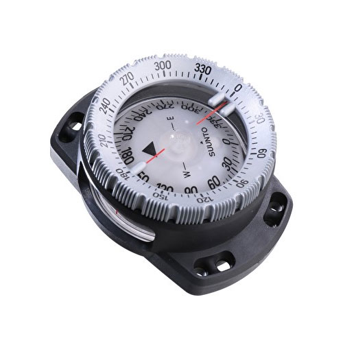
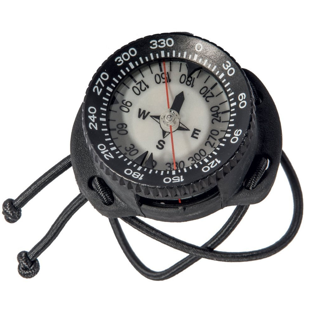
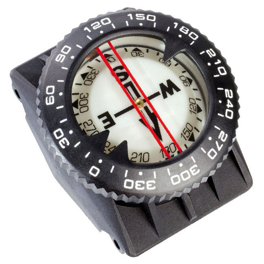
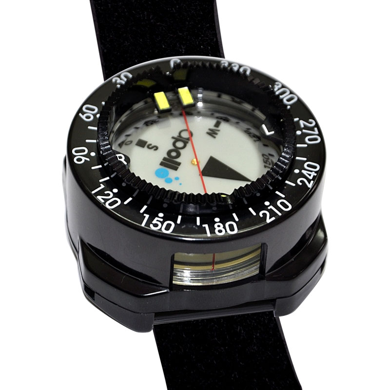
Many divers take diving compasses for granted, considering them just an accessory to an overall dive gauge console system. Trying to navigate with a poorly designed or improperly functioning compass can be one of diving's more frustrating events.
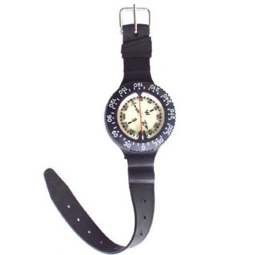
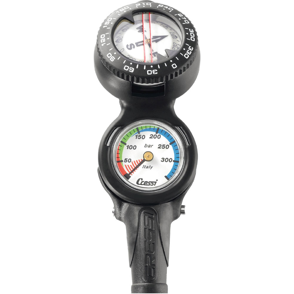
Compasses vary in greatly in where they are worn/attached and this is down to personal diver preference. From wrist mounted compasses with straps or bungees to a gauge mounted compass, we have every variation
We only stock the very best underwater and diving compasses to ensure that you are on track at all times. We use and recommend the Suunto range of wrist mount dive compasses, but have plenty of options from other brands like Cressi as well.
Technical Tip
Compass Balance Zones
Compasses are designed for use within a certain area of the globe because the earth's magnetic field not only varies horizontally, but also vertically, causing the needle to dip downward when the case is held level. The compass needle card is balanced with a small weight to counteract the downward dip so the needle card does not drag or stick on the top or bottom of the capsule. If you take any compass to a significantly different part of the globe than where it was balanced, check the compass carefully before relying upon it. The compasses we sell are balanced for the southern hemisphere.
Digital Compasses
Note that digital compasses, like the ones becoming popular in dive computers, do not have balance zones. Digital compasses are universal because they have a user 'calibration' feature, which is performed in the region where the diver plans to use the compass. A change in region simply requires a recalibration before use in the new location
Earl Of Charlemont
![]() Wreck Dive |
Wreck Dive | ![]() Shore access
Shore access
![]()
![]()
![]()
Three-Masted Wooden Ship | Max Depth: 5 m (16 ft)
The Earl Of Charlemont shipwreck lies on the southern side of Barwon Bluff, Barwon Heads on Victoria's Surf Coast in Bass Strait. The Earl of Charlemont struck what is now known as Charlemont Reef, about one mile south-west of Barwon Heads, then was carried onto the shallow reef directly in front of Barwon Bluff, where remains of the wreck lie sanded up for most of the year and difficult to access due to breaking surf.
Diving the Earl Of Charlemont Shipwreck
The remains of the Earl Of Charlemont were found by divers in the early 1960s. It can be explored as a shore dive from Barwon Bluff South.
The site of the Earl Of Charlemont shipwreck is subject to sanding up with up to 2 metres of sand, but on the rare occasions it is exposed many artefacts can be seen on the site. While most of the hull has gone, chain, concretions and iron lie scattered about in the uneven limestone reef, and the remains of a cartwheel have been reported. Buttons, coins and other small metal objects have survived as evidence of the immigrants' lost possessions.
Location GPS coordinates from Google Earth. Approximate location only.
Location: Barwon Heads, Victoria 3227
MELWAY Ref: Page 497 C6
Beach Marker: 28W
Parking: When heading south from Barwon Heads on Ewing Blyth Drive turn left onto Bluff Road. You'll first come to a car parking area which is good if you intend to dive the Earl Of Charlemont. Before gearing up check out the water. Do the short walk over the crest and check out the sea. If you see lots of white water, head on home.
Entry/Exit: Gear up and walk down the ramp to the beach. Walk onto the rock shelf and as far east as you want to go. Enter the water via the rock shelf. Swim out towards the Earl Of Charlemont shipwreck. Return to car via the same way. Foot protection on the rocks is beneficial.
See WillyWeather (Barwon Heads) as a guide for the tide times and the height of the tide.
Bass Strait Warning: Always keep an eye on sea conditions throughout any shore or boat dive in Bass Strait on Victoria's coastline. Please read the warnings on the web page diving-in-bass-strait before diving or snorkelling this site.
Earl Of Charlemont History — Built in 1849
The Earl Of Charlemont was a three-masted, wooden, ship rigged vessel of 883 t (973 s-ton), built in 1849, at St John, New Brunswick, Canada. The vessel had an overall length of approximately 147.8 ft (45 m), beam 30.6 ft (9.33 m) and draught 22.7 ft (6.92 m).
Earl Of Charlemont Sinking — 18 June 1853
The Earl Of Charlemont sailed from the Port of Liverpool on 3 March 1853 with 435 immigrants and a crew of 37 under the coomand of Captain William Gardner. The first port of call was to be Melbourne, before continuing to Sydney with the majority of the passengers.
The Earl Of Charlemont reached Cape Otway on 17 June 1853, and set a course for Port Phillip some 56 miles away. At 5.15 a.m. on Saturday 18 June 1853 the ship struck a reef (later named Charlemont Reef) about 1.5 miles from Point Flinders, Barwon Heads. An attempt to launch the ships boats failed in the heavy surf, so the main mast was cut down to lighten ship, which then washed over the reef and grounded nearer shore.
The following account of the arrival and wrecking of the ship Earl of Charlemont is taken from a report in the Argus, 21 June 1853:
"The Earl of Charlemont, 878 tons, Captain Garner, one of the Fox Line of Australian Packets, with 435 passengers, for Melbourne and Sydney, from Liverpool, went ashore at the Barwon Heads on Saturday morning. She sighted Cape Otway on Friday last, passed it about twelve o'clock, and kept off about two miles from shore. About five o'clock the same evening, she was twenty miles from the Lighthouse, a breeze blowing off the shore. The vessel lay to for the night, which was quite clear, the moonlight lasting until four o'clock, when the vessel struck. There was no wind at the time, but the tide was setting in strongly, and the vessel bumped so violently, that the foremast went over the bows at once, carrying away the rigging, and so close was the vessel to the shore, that some of the crew clambered down the chains, along the fallen mast, and made to the shore by swimming a few yards. The vessel then fell on her starboard side, and began to fill, and the tide rising made a clean breach over her. Three lifeboats were immediately launched, and three attempts were made to carry a rope ashore; each attempt failed; the boats were capsized, but the crew manning them escaped and getting ashore, cowardly left their companions and passengers to their fate. During this time the greatest order prevailed. Mr Savage, a steerage passenger, then undertook to carry a rope to the land, swam ashore, at the risk of his life, and successfully accomplished it. The life boats were then attached to the rope, and the lady passengers and children were safely landed, then the married men, and finally the bachelors, with the exception of about forty, who dropped over the bows of the ill-fated vessel, and swam ashore some time before the rope was fastened to the land, rendering assistance to the boats, and carrying the female passengers through the surf. Not one life was lost. Fires were lighted, round which the passengers crowded; some food was procured from the vessel, some sheep; and a bullock from Mr McVean's station, and there all lay that night unhoused."
The passengers and crew were all safely ferried ashore by 8.30 p.m., apart from one elderly passenger named Thwaites, who died from a heart attack, and was buried on the headland.
The wreck site of the Earl of Charlemont is historically and archaeologically significant for the remains of its cargo and passengers' belongings from an international immigrant ship of the gold rush period, representing the cultural material being bought out to Australia in a typical immigrant ship. It is socially significant for the descendants of the many immigrants who made it ashore safely, and who have erected a memorial cairn to their forbears on Point Flinders.
See also, Wikidedia: Earl of Charlemont (ship),
Heritage Council Victoria: Earl Of Charlemont,
Australian National Shipwreck Database: Earl Of Charlemont, and
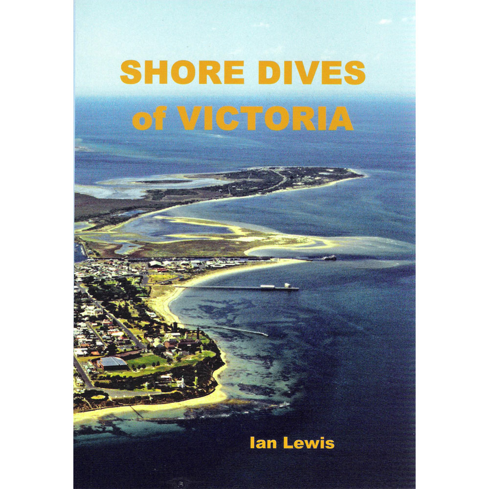
Barwon Heads... ...the Kelp Forest ...and the Wreck of the Orungal in "Shore Dives of Victoria" by Ian Lewis, 3rd edition pages 46–48.
Heritage Warning: Any shipwreck or shipwreck relic that is 75 years or older is protected by legislation. Other items of maritime heritage 75 years or older are also protected by legislation. Activities such as digging for bottles, coins or other artefacts that involve the disturbance of archaeological sites may be in breach of the legislation, and penalties may apply. The legislation requires the mandatory reporting to Heritage Victoria as soon as practicable of any archaeological site that is identified. See Maritime heritage. Anyone with information about looting or stolen artefacts should call Heritage Victoria on (03) 7022 6390, or send an email to heritage.victoria@delwp.vic.gov.au.
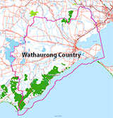
Traditional Owners — This dive site is in the traditional Country of the Wathaurong (Wadda-Warrung) people of the Kulin Nation. This truly ancient Country includes the coastline of Port Phillip, from the Werribee River in the north-east, the Bellarine Peninsula, and down to Cape Otway in the south-west. We wish to acknowledge the Wathaurong as Traditional Owners. We pay respect to their Ancestors and their Elders, past, present and emerging. We acknowledge Bunjil the Creator Spirit of this beautiful land, who travels as an eagle, and Waarn, who protects the waterways and travels as a crow, and thank them for continuing to watch over this Country today and beyond.
Earl Of Charlemont Location Map
Latitude: 38° 17.646′ S (38.294104° S / 38° 17′ 38.77″ S)
Longitude: 144° 29.813′ E (144.49688° E / 144° 29′ 48.77″ E)
Datum: WGS84 |
Google Map
| Get directions
Added: 2022-03-30 19:45:45 GMT, Last updated: 2022-04-27 09:50:24 GMT
Source: Google Earth (approximate location only)
Nearest Neighbour: Barwon Bluff South, 389 m, bearing 10°, N
Three-Masted Wooden Ship.
Built: St John, New Brunswick, Canada, 1849.
Sunk: 18 June 1853.
Barwon Bluff, Barwon Heads, Surf Coast.
Depth: 5 m.
[ Top ]
DISCLAIMER: No claim is made by The Scuba Doctor as to the accuracy of the dive site coordinates listed here. Should anyone decide to use these GPS marks to locate and dive on a site, they do so entirely at their own risk. Always verify against other sources.
The marks come from numerous sources including commercial operators, independent dive clubs, reference works, and active divers. Some are known to be accurate, while others may not be. Some GPS marks may even have come from maps using the AGD66 datum, and thus may need be converted to the WGS84 datum. To distinguish between the possible accuracy of the dive site marks, we've tried to give each mark a source of GPS, Google Earth, or unknown.



![Halcyon Infinity 30lb System [SS Small Backplate] Halcyon Infinity 30lb System [SS Small Backplate]](/diveshop/images/halcyon/Halcyon-Evolve-Wing.jpg)


